
License the modules your operation runs on
MTNFX is one platform sold by the module. A boutique cat operation licenses four; a full resort program licenses all sixteen. Every module reads and writes the same operational record, so nothing is entered twice.
Daily Operations
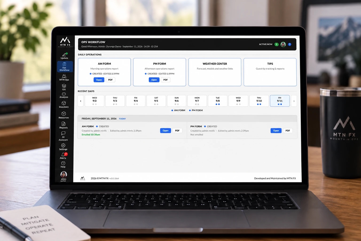
Ops Workflow
The daily dashboard where the AM Form, PM Form, and Weather Center live, with a rolling 30-day board of recent reports.
AM Form
The morning report: staffing, weather grid, avalanche problems, danger ratings, risk plan, and logistics. Autosaves as the team types, emails everyone on shift, and logs every change.
PM Form
The end-of-day report: day overview, 4 PM weather, observations, and tomorrow's plan. Observations carry forward into the next morning's AM Form.
Run List
Daily run status (Open, Evaluate, Closed) with carry-forward, so patrol updates only what changed overnight.
Runs Map
A 3D satellite map of zones, drops, and runs with live status colors, powered by Mapbox terrain.
Weather Center
NWS point forecast and discussion, an embedded Windy map, your preferred forecast models one click away, and a meteogram built from your own stations plus AM Form entries, with each value labeled by provenance.
Weather Integration & Forecasting
Station Integrations
Full weather integrations with LoggerNet, Synoptic, and Campbell Cloud. Connect the stations you already own and every reading lands in the same operational record your forms, meteograms, and reports read from.
Data Population
Choose how each value populates: manual entry by the forecaster or automatic from your stations. You set the population type, the pull times, and the station and field specifics per operation.
Forecasting
Build the morning hazard assessment on CMAH standards: avalanche problems by aspect and elevation, failure planes tracked from the season's layer record, and the conceptual hazard chart across all three elevation bands.
Avalanche Mitigation
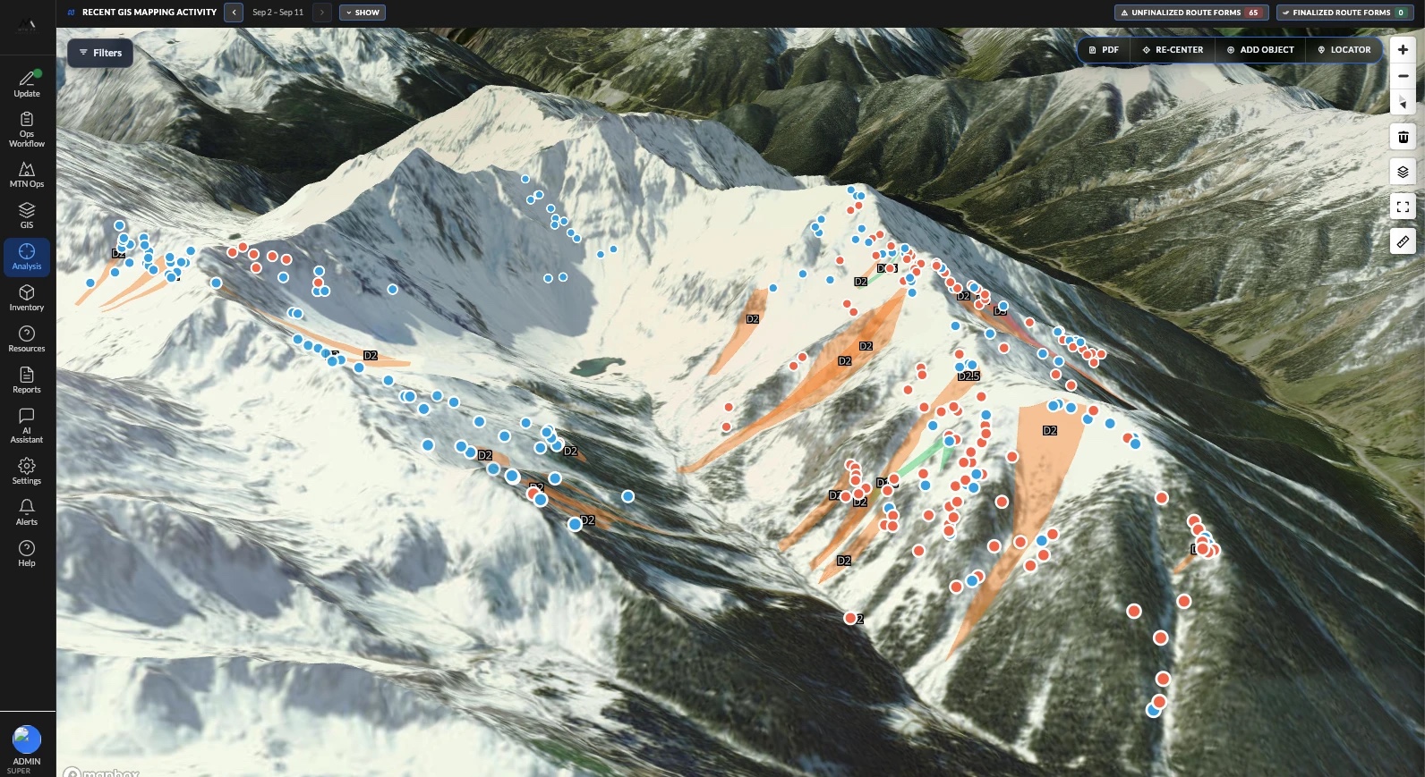
GIS Editor
The working map where teams record mitigation routes, ski cuts, bootpacks, avalanche observations, misc observations, and snow pit profiles as they happen.
Mitigation Routes
Full route forms: team, shot-by-shot explosives and results, misfires and resolutions, digital signature, finalization, and a PDF route form for the binder.
AvAtlas
Your library of saved terrain: avalanche paths, closed terrain, shot placements, and explosive routes, with GeoJSON import and export.
AV Analysis
The review map: an activity calendar, filters, atlas overlays, and external observation feeds layered over everything your team recorded.
Mobile Imports
Routes recorded in MTNFX Go! arrive on the web as imports for review and finalization. Nothing enters the record unreviewed.
InfoEx Integration
Submit avalanche observations to the CAA InfoEx exchange and see partner observations on your own map.
Explosives Inventory
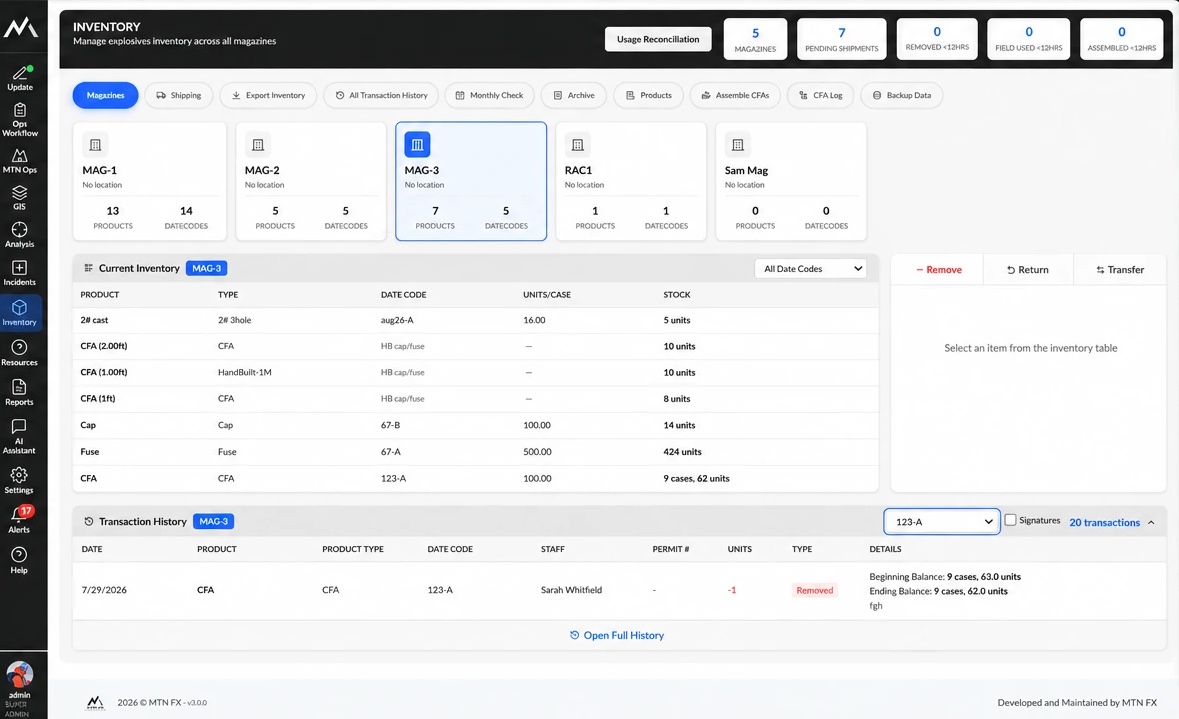
Lifecycle Tracking
Shipments, daily removals and returns, magazine transfers, monthly physical counts, and compliance exports. Every movement is signed; the audit trail can't be edited.
Cap & Fuse Assembly
CFA builds with their own log, so assembled product is accounted for separately from raw components.
Usage Reconciliation
Compares what left the magazines against what route forms say was fired, closing the loop between GIS and inventory, and blocking mismatches instead of hiding them.
Magazines & Shipping
Per-magazine balances, incoming shipments with invoice images, product costs, and archived lots.
Live Counters
Dashboard counters for product removed, field-used, and assembled within the last 12 hours. These are the numbers an inspector asks for first.
Compliance Backups
Scheduled per-tenant backups of the regulated record, with failure and missed-run alerts.
Incidents
Incident Reports
Medical events, walk-ins, care refusals, and avalanche involvements from first report through response, investigation, escalation, and sign-off.
Dispatch Board
Real-time responder assignment with response-time stamping.
Investigations
Formal investigations with witnesses, corrective actions, and OSHA tracking, plus a printable incident PDF including a location map.
Mountain Ops
Helicopters
Flight manifests, weight-and-balance calculations, run logging, and GPS tracks.
Snowcats
Daily cat operations: crew assignment, guest tracking, and runs skied.
Guest Management
Guest profiles, contact details, and liability waivers.
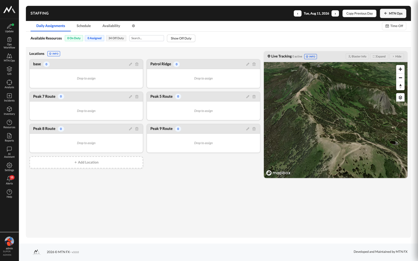
Staffing
Availability from the field, monthly schedules, day-of deployment, duty roles, certification expiry alerts, shift reminder emails, and a live map of on-duty staff.
Persistent Weak Layers
Zone-based snow depth and weak layer tracking across the season.
Grooming Beta
Per-run grooming sessions by shift with surface conditions.
Snowmaking Beta
Snowmaking sessions, gun assignments, pressure, depth, and production tracking.
Tips
Tip tracking with guest attribution and reporting.
Resources
Resource management and a shared document library.
Reports & AI
Ad-Hoc Report Builder
Custom queries over AM/PM form data, including your org's custom fields, with aggregation, period breakouts, charts, and PDF/CSV export.
Snow Safety Analysis
Per-person route counts, blaster-in-charge vs. assistant, path history, and blaster activity.
Compliance Reports
Explosive use by date, zone, and blaster; avalanche occurrences by D-size, zone, and aspect; helicopter Hobbs and vertical; a full route audit log.
Operations AI Assistant
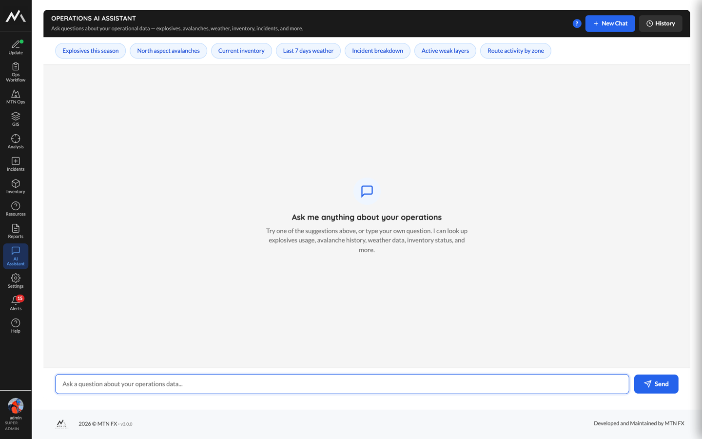
Ask plain-language questions about your own data, from explosives usage and avalanche activity to weather and incidents, and get tables, charts, and suggested follow-ups. Conversations are saved; usage is metered and visible.
Polish with AI
On AM Form narrative fields, rewrites your draft into a professional narrative that preserves the technical detail, with human review before anything is accepted.
AI Exports
Export any AI answer to PDF, Excel, or CSV, formatted like every other MTNFX report.
Your operation, walled off by design
MTNFX is multi-tenant the strict way: each operation runs on its own subdomain with full tenant data isolation. Data is encrypted in transit and stored in USA datacenters, and nothing crosses from one operation into another.
- Granular roles and permissions, enforced server-side
- Two-factor authentication and login throttling
- Custom fields and toggleable form sections per operation
- Notifications, alert rules, and in-app messaging